Key Rings, Novelty Flags, Point Shot, Boston Celtics, Bebidas, Chartbooks
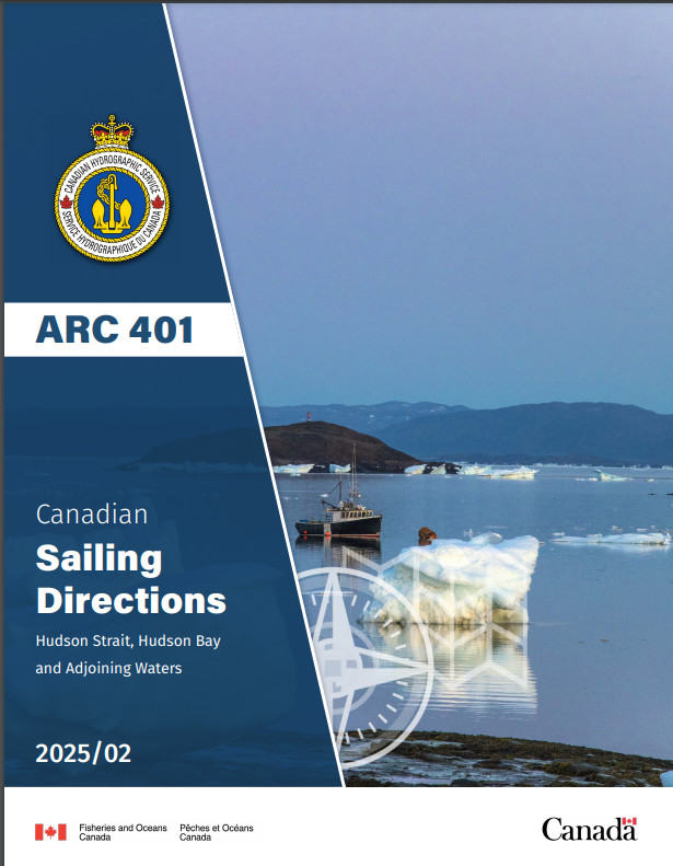
CHS SDIR ARC401 Hudson Strait & Bay 2025/02
$ 26.96
Sailing Directions Hudson Strait Hudson Bay and Adjoining Waters Canada ARC 401 Canadian Hydrographic Service Official Publication Northern and Arctic waters Sailing Directions are the indispensable companions to charts. A great tool for planning and assisting in navigation, Sailing Directions provide information that cannot be shown on a chart. Author: CHS Date: 2025 Format: Comb Bound Booklet Number of Pages: 164 CHAPTER 1 Hudson Strait — South Shore — Ungava BayGeneral ___________________________________________________ 1-1Ungava Bay — East Shore _____________________________________ 1-2Killiniq (Killinek) Island to Cap (Cape) William-Smith______________ 1-2Cap William-Smith to Rivière George (River) ____________________ 1-3Rivière George and Approaches ______________________________ 1-3Ungava Bay — South Shore ____________________________________ 1-4Rivière George to Rivière Koksoak (River) ______________________ 1-4Approaches to Rivière Koksoak (River)_________________________ 1-5Rivière Koksoak _________________________________________ 1-5Ungava Bay — SW Shore ______________________________________ 1-6Rivière Koksoak to Leaf Bay (Baie aux Feuilles) __________________ 1-6Leaf Bay and Lac aux Feuilles _______________________________ 1-7Leaf Bay to Hopes Advance Bay______________________________ 1-8Approaches to Hopes Advance Bay____________________________ 1-9Hopes Advance Bay to Payne Bay_____________________________ 1-9Approaches to Payne Bay and Rivière Arnaud (Payne River)_________ 1-10Rivière Arnaud (Payne River)_______________________________ 1-10NW part of Ungava Bay ______________________________________ 1-11Akpatok Island _________________________________________ 1-11Five Islands to Cap (Cape) Hopes Advance _____________________ 1-12CHAPTER 2 Hudson Strait — South Shore — Cap Hopes Advanceto Pointe Taliruq (Nuvuc)General ___________________________________________________ 2-1Diana Bay__________________________________________________ 2-1East side of Diana Bay _____________________________________ 2-2Central Islands in Diana Bay ________________________________ 2-2West side of Diana Bay ____________________________________ 2-3SW side of Diana Bay _____________________________________ 2-3South part of Diana Bay ____________________________________ 2-3Diana Bay to Wakeham Bay ____________________________________ 2-3Wakeham Bay and Approaches _______________________________ 2-4Wakeham Bay to Douglas Harbour ______________________________ 2-5Fisher Bay _____________________________________________ 2-5Fisher Bay to Douglas Harbour_______________________________ 2-6Approaches to Douglas Harbour ______________________________ 2-6 Off-lying islands _______________________________________ 2-6Douglas Harbour _________________________________________ 2-7Douglas Harbour to Deception Bay_______________________________ 2-7Foul Bay_______________________________________________ 2-7Deception Bay___________________________________________ 2-8Deception Bay to Cap Wolstenholme______________________________ 2-9Deception Bay to Sugluk Inlet _______________________________ 2-9Sugluk Inlet ____________________________________________ 2-9Sugluk Inlet to Erik Cove __________________________________ 2-11Erik Cove to Cap Wolstenholme _____________________________ 2-11IVCap Wolstenholme to Pointe Taliruq (Nuvuc) ______________________ 2-11Digges Islands__________________________________________ 2-11Passe Digges (Sound) ____________________________________ 2-12Mainland coast of Passe Digges _____________________________ 2-12CHAPTER 3 Hudson Strait — North ShoreGeneral ___________________________________________________ 3-1Resolution Island ____________________________________________ 3-1East, south and SW coasts __________________________________ 3-1Resolution Harbour _______________________________________ 3-2Cape Warwick to Baffin Island __________________________________ 3-4Baffin Island — East Bluff to Lake Harbour ________________________ 3-4Kimmirut (hamlet of Lake Harbour) and approaches________________ 3-7Lake Harbour to Fair Ness ____________________________________ 3-10SE shore of Big Island ____________________________________ 3-11SW shore of Big Island ___________________________________ 3-11Big Island to Fair Ness____________________________________ 3-11Fair Ness to Chorkbak Inlet ___________________________________ 3-12Chorkbak Inlet to Cape Dorset_________________________________ 3-12Cape Dorset and approaches________________________________ 3-13Cape Dorset to Lloyd Point____________________________________ 3-14CHAPTER 4 Hudson Bay — East SideGeneral ___________________________________________________ 4-1Pointe Taliruq to Cape Smith ___________________________________ 4-2Ice Harbour to Pointe Bernier ________________________________ 4-2Offshore islands__________________________________________ 4-2Pointe Bernier to Cape Smith ________________________________ 4-3Cape Smith to Akulivik________________________________________ 4-3Cape Smith to Cape Dufferin ___________________________________ 4-4Pointe Akulivik to Povungnituk Bay ___________________________ 4-4Approaches to Puvirnituq (Povungnituk) ________________________ 4-4Offshore islands__________________________________________ 4-6Povungnituk Bay to Cape Dufferin ____________________________ 4-7Cape Dufferin to Nastapoka Islands ______________________________ 4-7Cape Dufferin to Inukjuak __________________________________ 4-7Approaches to Inukjuak ____________________________________ 4-7Inukjuak to Rivière Nastapoka _______________________________ 4-8Offshore Islands — Marcopeet, Sleeper and King George Islands ______ 4-9Offshore islands — Belcher Islands____________________________ 4-9Belcher Islands — North part _______________________________ 4-10Belcher Islands — South part _______________________________ 4-11Nastapoka Islands _______________________________________ 4-12Rivière Nastapoka to Le Goulet ________________________________ 4-13Approaches to Umiujaq ___________________________________ 4-13Umiujaq to Le Goulet ____________________________________ 4-13Le Goulet to Pointe Louis-XIV _________________________________ 4-14Le Goulet to Grande rivière de la Baleine ______________________ 4-14Approaches to Kuujjuarapik (Poste-de-la-Baleine) ________________ 4-14Grande rivière de la Baleine to Long Island _____________________ 4-15Long Island and Long Island Sound __________________________ 4-16VCHAPTER 5 James BayGeneral ___________________________________________________ 5-1James Bay — East shore_______________________________________ 5-1Pointe Louis-XIV to Fort George (Fort-George) and Chisasibi_________ 5-2Approaches to Fort George (Fort-George) and Chisasibi _____________ 5-2Fort George and Chisasibi to Wemindji _________________________ 5-3Offshore islands__________________________________________ 5-4Approaches to Wemindji ___________________________________ 5-4Wemindji to Eastmain _____________________________________ 5-4Offshore islands__________________________________________ 5-5Approaches to Eastmain____________________________________ 5-5Eastmain to Waskaganish (Fort-Rupert)_________________________ 5-5Rupert Bay _____________________________________________ 5-6Approaches to Waskaganish (Fort-Rupert) _______________________ 5-6Waskaganish to Hannah Bay_________________________________ 5-7James Bay — West shore ______________________________________ 5-7Cape Henrietta Maria to Albany River__________________________ 5-7Offshore islands__________________________________________ 5-8Approaches to Attawapiskat _________________________________ 5-8Approaches to Kashechewan and Fort Albany ____________________ 5-9Albany River to Moosonee__________________________________ 5-9Approaches to Moose River ________________________________ 5-10CHAPTER 6 Southampton Island (South Side) and Chesterfield InletSouthampton Island (South Side) — General _______________________ 6-1Seahorse Point to Coral Harbour ______________________________ 6-2Evans Strait_____________________________________________ 6-2Fisher Strait ____________________________________________ 6-2Coral Harbour and approaches _______________________________ 6-3Coral Harbour to Cape Kendall_______________________________ 6-4Hudson Bay — NW shore — Cape Fullerton to Chesterfield Inlet________ 6-4Approaches to Chesterfield Inlet ______________________________ 6-5Chesterfield Inlet — General ___________________________________ 6-6Chesterfield Inlet entrance to Ellis Island ________________________ 6-6Ellis Island to Centre Island _________________________________ 6-9Centre Island to Farther Hope Point____________________________ 6-9Farther Hope Point to Terror Point ___________________________ 6-10Terror Point to Baleen Island _______________________________ 6-11Baleen Island to Chesterfield Narrows _________________________ 6-11Chesterfield Narrows _____________________________________ 6-12Baker Lake________________________________________________ 6-12Chesterfield Narrows to James Point __________________________ 6-12James Point to Baker Lake hamlet____________________________ 6-13Baker Lake Harbour _____________________________________ 6-14CHAPTER 7 Hudson Bay — West SideGeneral ___________________________________________________ 7-1Chesterfield Inlet to Rankin Inlet ________________________________ 7-1Rankin Inlet and approaches_________________________________ 7-2Rankin Inlet to Eskimo Point ___________________________________ 7-4Rankin Inlet to Whale Cove _________________________________ 7-4Whale Cove and approaches_________________________________ 7-4Walrus Island to Eskimo Point _______________________________ 7-5Eskimo Point and approaches ________________________________ 7-6VIEskimo Point to Churchill _____________________________________ 7-7Eskimo Point to Egg Island _________________________________ 7-7Egg Island to Churchill ____________________________________ 7-7Approaches to Churchill Harbour _____________________________ 7-7Churchill Harbour ________________________________________ 7-8Port of Churchill ________________________________________ 7-10Churchill to James Bay_______________________________________ 7-10Cape Churchill to Cape Tatnam______________________________ 7-11Cape Tatnam to Fort Severn ________________________________ 7-11Fort Severn to Winisk River ________________________________ 7-12Winisk River to Cape Henrietta Maria _________________________ 7-12CHAPTER 8 Foxe Channel — Roes Welcome SoundGeneral ___________________________________________________ 8-1Foxe Channel _______________________________________________ 8-1Offshore dangers _________________________________________ 8-2West side of Foxe Channel — Southampton Island _________________ 8-2East side of Foxe Channel __________________________________ 8-3Frozen Strait _______________________________________________ 8-3SW side of Frozen Strait and approaches ______________________
Related products
-

-
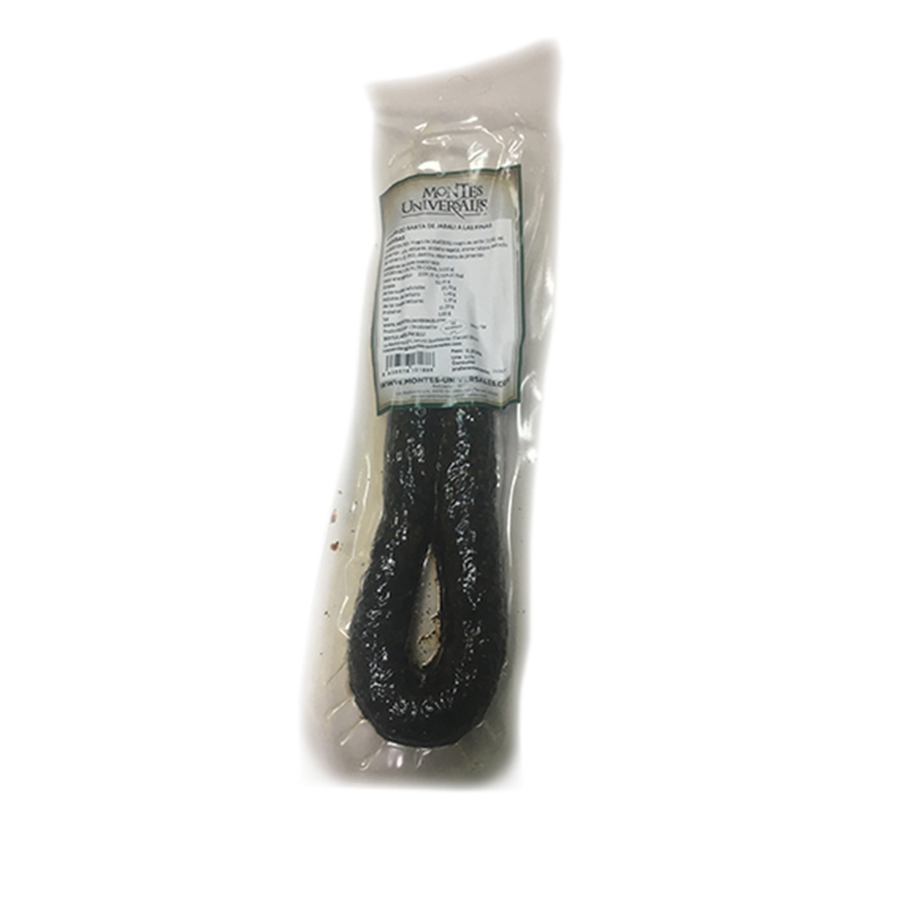
 Notions Chorizo Sarta de Jabalí a las finas hierbas estuchado – 250 g $ 22.69 Select options This product has multiple variants. The options may be chosen on the product page
 -

-