Nv Charts, Chartbooks, Point Shot, Gift Ideas, Pacific, Oceania & Indian Ocean Flags, Training & Study Guides
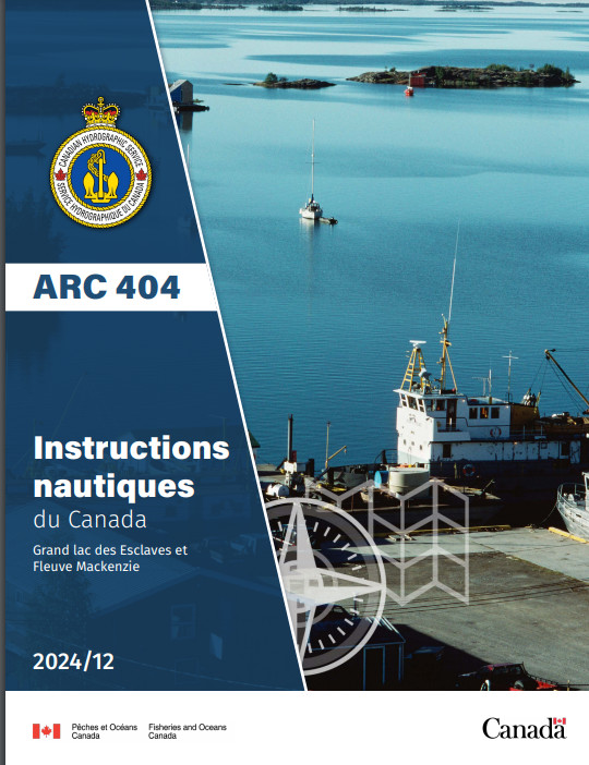
CHS SDIR ARC404F Great Slave Lake & Mackenzie River 2024/12 (French)
$ 22.46
CHS SDIR ARC404 Great Slave Lake & Mackenzie River 2021 (French) The Sailing Directions booklets are an indispensable companion to nautical charts. They are a great tool for planning and assisting in navigation because they provide information that cannot be shown on a chart. Author: CHS Date: 2021 Format: Comb Bound Booklet Number of Pages: 124 CHAPTER 1 Great Slave Lake — West shoreGeneral _________________________________________________________ 1-1Great Slave Lake — West Shore_____________________________________ 1-2Slave Point to Gypsum Point ____________________________________ 1-2CHAPTER 2 Great Slave Lake — North ArmGeneral _________________________________________________________ 2-1Approach to Yellowknife Bay ___________________________________ 2-3Yellowknife Bay ______________________________________________ 2-4Approach to Hearne Channel ____________________________________ 2-7CHAPTER 3 Great Slave Lake — East armGeneral _________________________________________________________ 3-1Off-lying Islands______________________________________________ 3-2Entrance Channels________________________________________________ 3-2Hearne Channel ______________________________________________ 3-2Inconnu Channel______________________________________________ 3-2Hornby Channel ______________________________________________ 3-3McLeod Bay _____________________________________________________ 3-4Christie Bay _____________________________________________________ 3-5CHAPTER 4 Athabasca River — Lake Athabasca — Slave RiverGeneral _________________________________________________________ 4-1Athabasca River __________________________________________________ 4-2Lake Athabasca __________________________________________________ 4-4Athabasca River to Fort Chipewyan_______________________________ 4-5Lake Athabasca to Slave River___________________________________ 4-6Slave River ______________________________________________________ 4-6Upper Slave River ____________________________________________ 4-6Lower Slave River ____________________________________________ 4-7Slave River delta______________________________________________ 4-8CHAPTER 5 Great Slave Lake — South shoreGeneral _________________________________________________________ 5-1Slave River delta to Hay River___________________________________ 5-1Hay River ___________________________________________________ 5-3Hay River to Mackenzie River ___________________________________ 5-6CHAPTER 6 Mackenzie River — Great Slave Lake to Morrisey CreekGeneral _________________________________________________________ 6-1Great Slave Lake to Morrisey Creek _________________________________ 6-3Approaches to Mackenzie River _________________________________ 6-4South Channel _______________________________________________ 6-4Beaver Lake _________________________________________________ 6-5Providence Rapids ____________________________________________ 6-5Providence Island to Mills Lake__________________________________ 6-6Mills Lake___________________________________________________ 6-9Mills Lake to Morrisey Creek ___________________________________ 6-9IVCHAPTER 7 Mackenzie River — Morrisey Creek to Fort Simpson —Liard River and Fort Nelson RiverGeneral _________________________________________________________ 7-1Approach to Head-of-the-line____________________________________ 7-2Head-of-the-line to Rabbitskin River ______________________________ 7-3Rabbitskin River to Green Island Rapids ___________________________ 7-4Green Island Rapids ___________________________________________ 7-5Green Island Rapids to Fort Simpson______________________________ 7-6Liard River and Fort Nelson River __________________________________ 7-9General _____________________________________________________ 7-9Fort Simpson to Fort Nelson ____________________________________ 7-9CHAPTER 8 Mackenzie River — Fort Simpson to WrigleyGeneral _________________________________________________________ 8-1Fort Simpson to Trail River _____________________________________ 8-2Trail River to North Nahanni River _______________________________ 8-3Camsell Bend to Jones Landing __________________________________ 8-4Jones Landing to Wrigley_______________________________________ 8-6CHAPTER 9 Mackenzie River — Wrigley to Tulita (Fort Norman)General _________________________________________________________ 9-1Wrigley to Blackwater River ____________________________________ 9-2Blackwater River to Old Fort Point _______________________________ 9-4Old Fort Point to Tulita (Fort Norman) ____________________________ 9-9CHAPTER 10 Mackenzie River — Great Bear River and Great Bear Lake —Tulita to The RampartsGeneral ________________________________________________________ 10-1Tulita to The Ramparts ___________________________________________ 10-2General ____________________________________________________ 10-2Tulita to Norman Wells________________________________________ 10-3Norman Wells to Carcajou Ridge________________________________ 10-7Approach to Sans Sault Rapids _________________________________ 10-9Sans Sault Rapids and North Rapids ____________________________ 10-10North Rapids to The Ramparts _________________________________ 10-12Ramparts Rapids____________________________________________ 10-13CHAPTER 11 Mackenzie River — The Ramparts to Point SeparationGeneral ________________________________________________________ 11-1The Ramparts to Fort Good Hope _______________________________ 11-2Fort Good Hope to Askew Islands _______________________________ 11-3Askew Islands to Bryan Island__________________________________ 11-5Bryan Island to Travaillant River ________________________________ 11-5Travaillant River to Adam Cabin Creek ___________________________ 11-7Adam Cabin Creek to Lower Ramparts ___________________________ 11-7Lower Ramparts _____________________________________________ 11-8Arctic Red River_____________________________________________ 11-9Arctic Red River to Point Separation ____________________________ 11-10CHAPTER 12 Mackenzie River — Mackenzie DeltaGeneral ________________________________________________________ 12-1Mackenzie Delta — SW part_______________________________________ 12-2Peel River Approaches ________________________________________ 12-2Peel River __________________________________________________ 12-2VPeel Channel and Husky Channel _______________________________ 12-3Aklavik Channel_____________________________________________ 12-4Aklavik ____________________________________________________ 12-4West Channel _______________________________________________ 12-6Mackenzie Delta — Middle Channel ________________________________ 12-6Point Separation to Aklavik Channel _____________________________ 12-6Aklavik Channel to Napoiak Channel ____________________________ 12-7Napoiak Channel ____________________________________________ 12-7Napoiak Channel to Neklek Channel _____________________________ 12-8Neklek Channel _____________________________________________ 12-9Reindeer Channel ____________________________________________ 12-9Neklek Channel to Mackenzie Bay ______________________________ 12-9Mackenzie Delta — East Channel _________________________________ 12-10East Channel — South Section_________________________________ 12-10Inuvik ____________________________________________________ 12-10Inuvik to Net Point __________________________________________ 12-12Net Point to Neklek Channel __________________________________ 12-12Neklek Channel to Lousy Point ________________________________ 12-12Lousy Point to Kittigazuit Bay_________________________________ 12-13Kittigazuit Bay _____________________________________________ 12-13Kugmallit Bay _____________________________________________ 12-14Kugmallit Bay — South Side__________________________________ 12-14
Related products
-
-
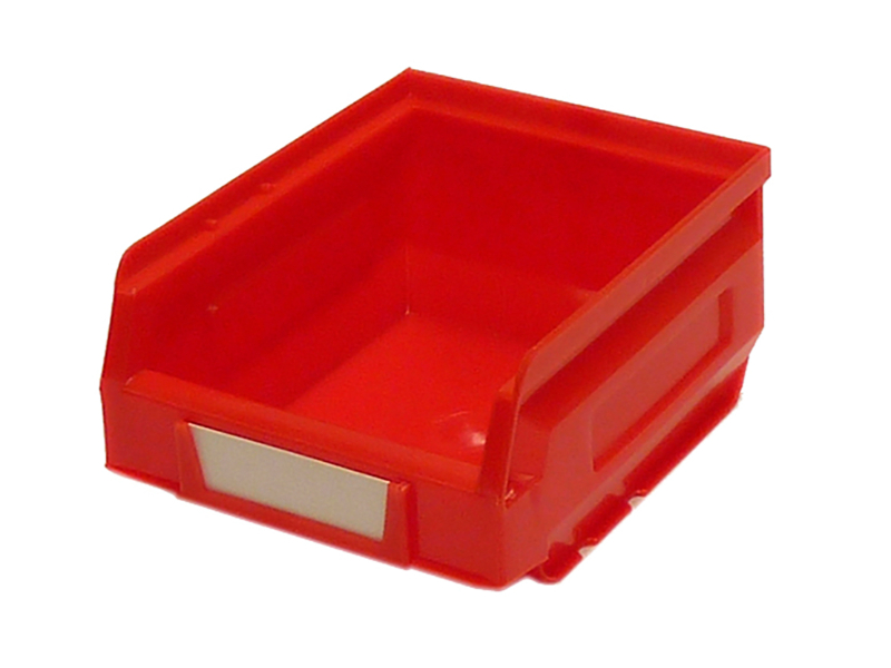
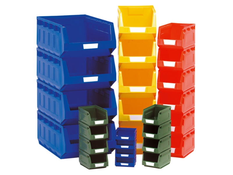
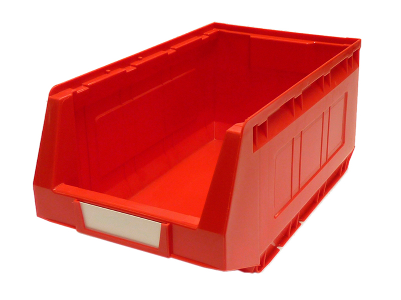 Notions Red Stackable Storage Parts Bins – Plastic Bin Kit 2004 (Pack of 12). WxDxH: 207X345X165mm Red _SKU-13020432 $ 93.38 Select options This product has multiple variants. The options may be chosen on the product page
 -
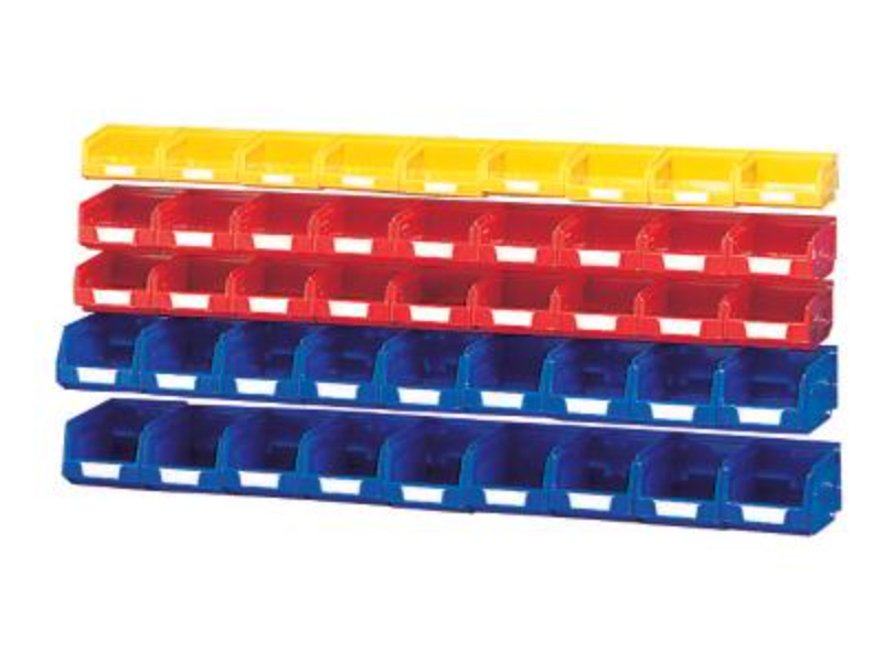
 Crochet Notions Small Component Boxes – Plastic Bin Kit Mixed (Pack of 27). Mixed Colours _SKU-13031196 $ 91.34 Add to cart
 -